Address
PO Box 99
Godalming
Surrey
South East England
GU7 2XT
England UK
Opening Hours
Today
08:30-17:00
View All Hours
Sunday
Closed
Monday
08:30-17:00
Tuesday
08:30-17:00
Wednesday
08:30-17:00
Thursday
08:30-17:00
Friday
08:30-17:00
Saturday
Closed
Other Dates
We can also offer out of hours working for survey works required during nights or at weekends.
About Geotec Surveys Ltd
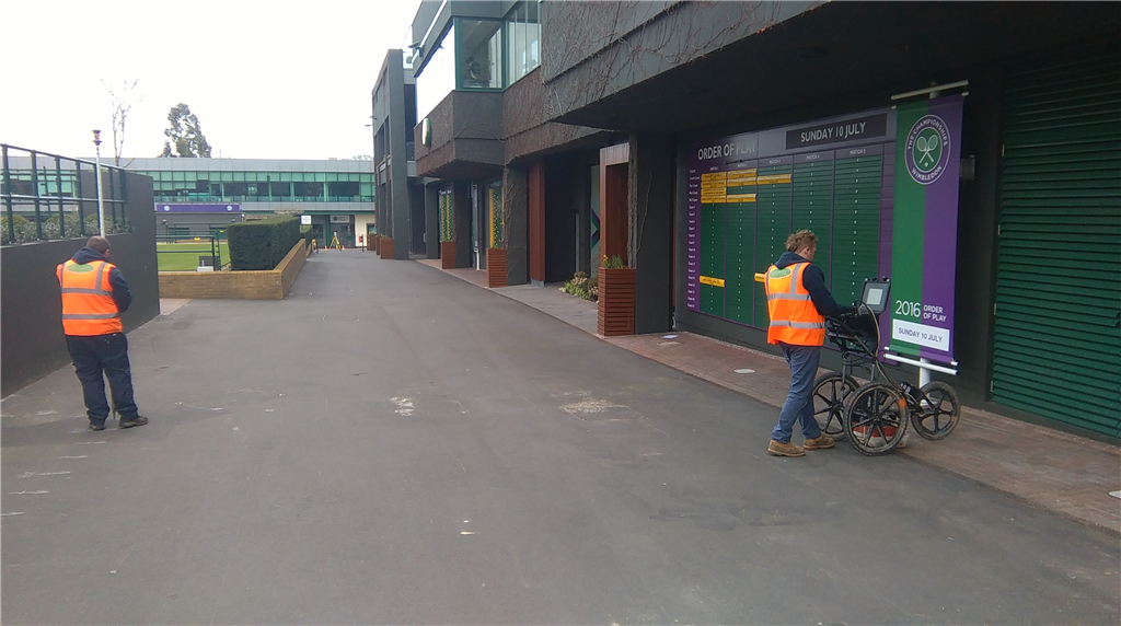
Formed in 1998, GEOTEC Surveys Ltd are a Manufacturer Independent Specialist of Non-Invasive Underground Mapping Surveys for Buried Services, Utilities, Voids and Subsurface Features as well as the associated Topographical Surveys.
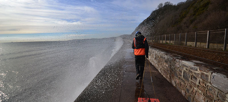
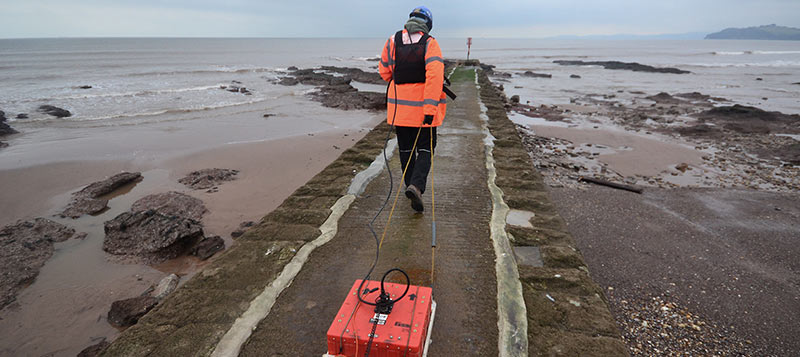
We utilise a range of geophysical survey techniques, such Electromagnetics (EML) & Ground Penetrating Radar (GPR) to meet our clients objectives.
Underground Mapping
The first priority for most clients is utilities, but GEOTEC's Survey services go much deeper than this.
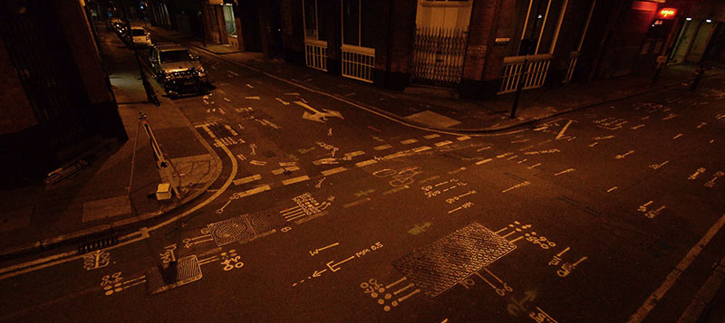
GEOTEC Surveys map the sub-surface environment for a wide range of features comprising buried services (to PAS 128), voids, anomalies & obstructions to assist our client for planning, design & health & safety purposes.
Benefits
Underground Mapping helps Design the Risk out of projects to:
A GEOTEC Underground Utility Mapping Survey is one of the most comprehensive services on the market, compliant with PAS 128 standard, utilising EML & GPR.
Advantages of an Underground Utility Mapping Survey:
GEOTEC's services go much deeper than utilities and services. Using proven geophysical methods, GEOTEC Surveys map the sub-surface environment, for a range of features using a number of approaches.
Geophysical Approaches & Applications
Typical features which can be located are:
A PAS 128 Type D Desktop Study offers one stop shop, providing a cost effective, clear and concise statutory utility plan of your site on one single drawing.
Our approach takes away the headache of approaching countless utility providers and understanding near illegible records in a variety of formats and scales. Our CAD Technicians are also Utility Mapping Surveyors and can draw on their experience to interpret these records and plot them in line with how particular services are likely to be positioned in real life.
Sub-Surface Consultancy
Our office based staff, have a combined 35 years experience and can assist you with subsurface anomalies, hazards and concerns.
It is our responsibility to recommend the best methodologies and approaches to move your project forward, in the event of a Buried Unknown, which may delay design or construction works.
Geotec Surveys can provide unrivalled information on a wide variety of environments:
We utilise a range of geophysical survey techniques, such Electromagnetics (EML) & Ground Penetrating Radar (GPR) to meet our clients objectives.
Underground Mapping
The first priority for most clients is utilities, but GEOTEC's Survey services go much deeper than this.
GEOTEC Surveys map the sub-surface environment for a wide range of features comprising buried services (to PAS 128), voids, anomalies & obstructions to assist our client for planning, design & health & safety purposes.
Benefits
Underground Mapping helps Design the Risk out of projects to:
- Decrease risk of harm & injury to persons
- Decrease risk of damaging buried apparatus
- Meet CDM and HSG47
- Minimise disruption & inconvenience to general public
- Minimise project delays& reduce costs
- Understand service diversion needs
- Pin-point invasive investigation requirements (trial pits, boreholes, window sampling & core sampling for example)
- Negate unnecessary excavations
A GEOTEC Underground Utility Mapping Survey is one of the most comprehensive services on the market, compliant with PAS 128 standard, utilising EML & GPR.
Advantages of an Underground Utility Mapping Survey:
- Ground Penetrating Radar Data detail evaluated & scrutinised
- Cross referenced against Statutory Undertakers Records.
- Permanent record at a single point in time.
- Overlay proposed design solutions / assist with clash management.
- Manhole and Photo Schedules on request.
- Results can be fed into 3D & BIM software.
GEOTEC's services go much deeper than utilities and services. Using proven geophysical methods, GEOTEC Surveys map the sub-surface environment, for a range of features using a number of approaches.
Geophysical Approaches & Applications
Typical features which can be located are:
- Mine shafts
- Old foundations/ building lines
- Pile caps
- Hidden wells
- Footings
- Basements, cellars
- Tunnels and underground voids
- Chalk dissolution
A PAS 128 Type D Desktop Study offers one stop shop, providing a cost effective, clear and concise statutory utility plan of your site on one single drawing.
Our approach takes away the headache of approaching countless utility providers and understanding near illegible records in a variety of formats and scales. Our CAD Technicians are also Utility Mapping Surveyors and can draw on their experience to interpret these records and plot them in line with how particular services are likely to be positioned in real life.
Sub-Surface Consultancy
Our office based staff, have a combined 35 years experience and can assist you with subsurface anomalies, hazards and concerns.
It is our responsibility to recommend the best methodologies and approaches to move your project forward, in the event of a Buried Unknown, which may delay design or construction works.
Geotec Surveys can provide unrivalled information on a wide variety of environments:
- Highways
Constant construction and changing city centres often render utility company drawings inaccurate. - Greenfield sites
A survey allows pipework, foundations or piles to be laid quickly and easily by pinpointing the depth of bedrock and any subsurface anomalies. - Brownfield sites
A range of subsurface anomalies such as abandoned services, evidence of previous developments, reinforced concrete, among other hazards are common. Specialist Geophysical techniques allow GEOTEC to search to a depth of 6m, which have proved invaluable to clients. - Sewers, drains and treatment plants
Water pipes and other crucial services, such as fibre optic communications and telemetry are often laid in complex patterns with little or no record maintained of their location. Being mainly non-metallic in structure makes them invisible to CAT and Genny machines. GEOTEC can provide a complete picture to facilitate detailed design and safe construction. - Substations
Accurate mapping of sensitive underground services and detailed topographical surveying across utility distribution sites is crucial to design works and dramatically reduces the amount of digging required, providing excellent Health & Safety data, whilst allowing ‘permits to work' to be issued.
Gallery
Products & Services
Team
| Name | Role | Telephone | |
|---|---|---|---|
| Thomas Skilleter | Senior Project Consultant | tskilleter@geotecsurveys.com | 01428 686168 |
| Luke Hammond | Senior Project Consultant | lhammond@geotecsurveys.com | 01428 686168 |
| Brian Payne | Director | bpayne@geotecsurveys.com | 02844 828258 |
| Julian Sperling | Sales Manager | jsperling@geotecsurveys.com | 01428 686168 |
| David Todd | Survey Manager | dtodd@geotecsurveys.com | 02844 828258 |
| Carole Kitson | Project Co-ordinator | ckitson@geotecsurveys.com | 01428 686168 |
 UK
UK Ireland
 Scotland
 London


