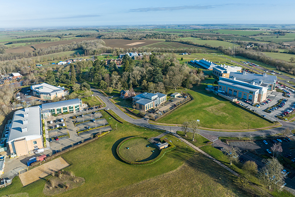
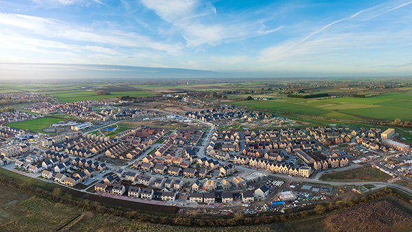
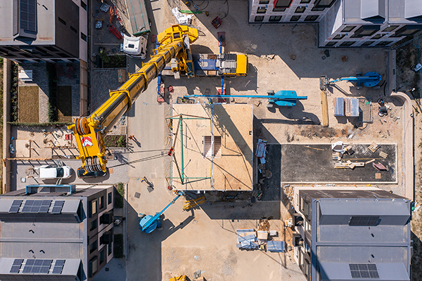
Northstowe
About Skytech Cambridge Ltd
Skytech Cambridge is a leading provider of innovative drone services, offering tailored solutions for businesses across the UK and internationally. With expertise spanning drone surveys, asset inspections, 3D modelling, thermal imaging, and high-quality filming, we are committed to delivering exceptional results for every project.
Based in Cambridgeshire, we leverage cutting-edge technology and deep industry experience to provide comprehensive drone-based solutions that save time, minimise risk, and reduce costs. Our services include:
Drone Surveys, Inspections & Mapping
Skytech Cambridge delivers fast, accurate, and cost-effective visual oversight of high-level buildings and structures. Our team can typically be deployed for inspections within 24 hours across the UK, delivering high-resolution imagery and secure live streaming to stakeholders worldwide.
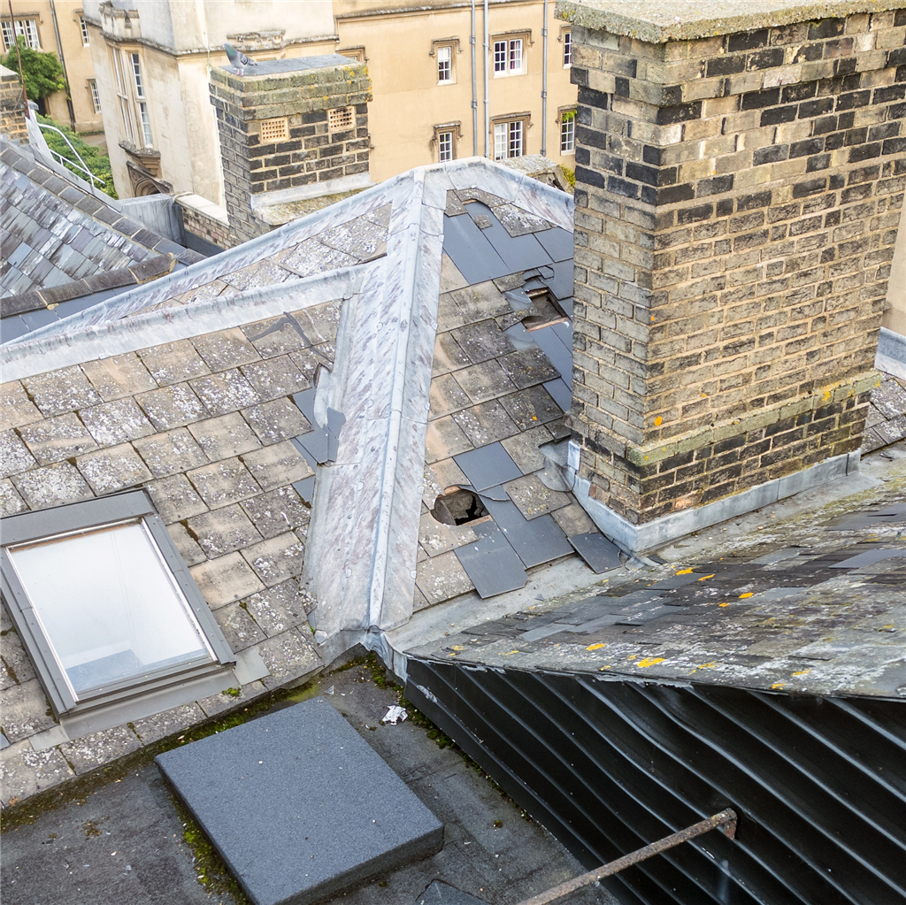
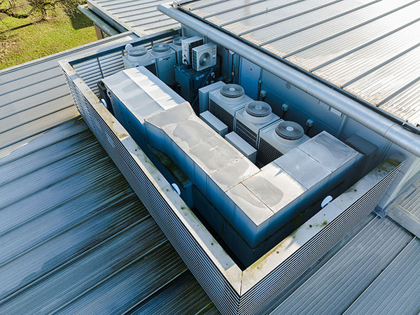
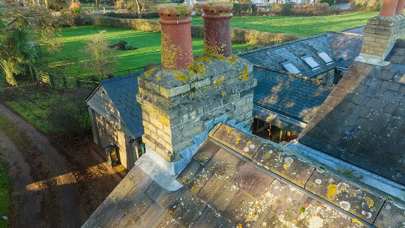
Our drones are designed to access difficult and potentially unsafe areas, enabling us to produce survey-accurate imagery for various projects. From roof surveys and topographic land mapping to precise data capture compatible with BIM, GIS, AutoCAD, and other business systems, we ensure your needs are met to the highest quality standards.
Drone Filming & Photography
With our state-of-the-art fleet of DJI cinema drones, we deliver stunning aerial footage in resolutions up to 8K and frame rates of 120fps. Whether you're looking to create captivating films or visually compelling photography, our drones bring your vision to life.
Additionally, we offer FPV (First-Person View) drone filming for a modern, immersive videography style that adds dynamic energy to any project.
Drone Traffic Surveys
Skytech Cambridge is revolutionising urban planning and traffic management with cutting-edge drone-based traffic surveys. By capturing high-resolution aerial footage and applying state-of-the-art video analytics, we provide invaluable data and behavioural insights. This modern approach empowers planners to address the complexities of traffic dynamics with precision and efficiency.
Drone 2D/3D Scans, Data Capture & 3D Modelling
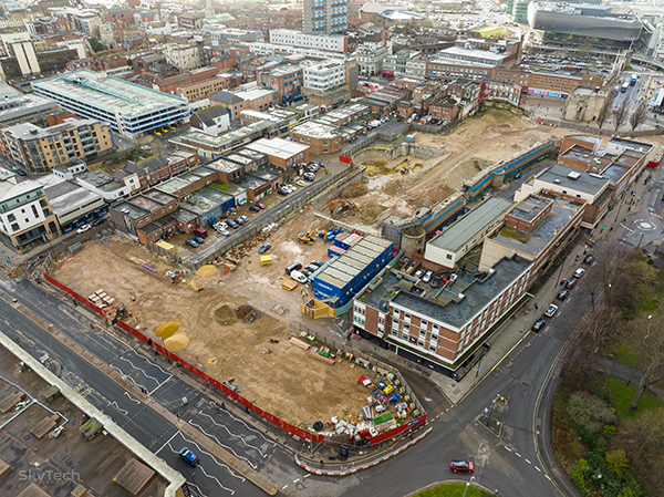
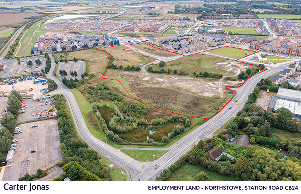
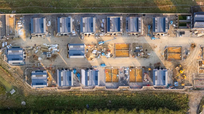
Using advanced photogrammetry techniques and RTK positioning data, our drones create incredibly accurate and detailed 2D and 3D maps. From individual buildings to extensive construction sites or agricultural land, our services offer unparalleled accuracy for design, planning, and analysis.
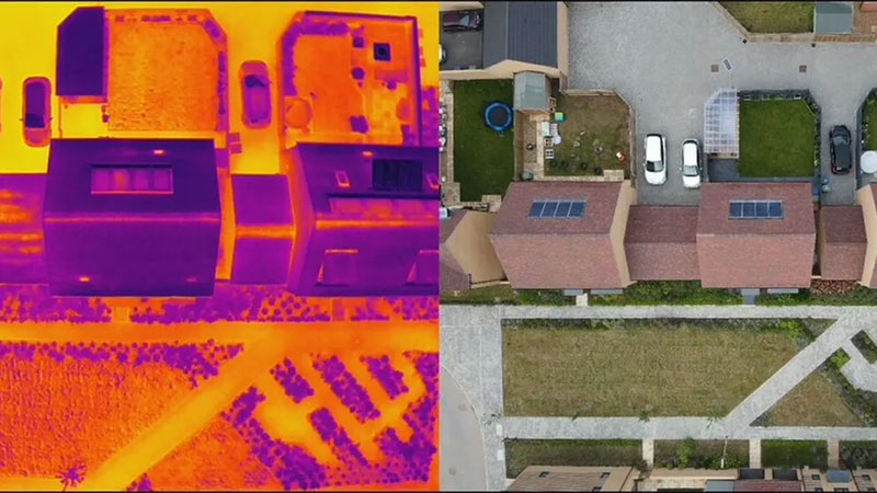
Drone Thermal Imaging
At Skytech Cambridge, we leverage industry-leading thermal imaging technology to deliver high-resolution radiometric images and video for a wide range of applications. Our expertise includes:
- Building Heat Loss Surveys: Identify areas of heat loss to improve energy efficiency.
- Roof Water Ingress Detection: Pinpoint water leaks and damage with precision.
- Cold Spot Analysis: Detect insulation issues or areas requiring maintenance.
- Solar Panel Inspections: Ensure optimal performance and identify faults in photovoltaic systems.
Our thermal imaging drones are an invaluable tool for roof and building envelope surveys, security oversight, event management, and more. With precise, actionable insights, we help optimise safety, performance, and efficiency across every project.
Drone Security & Event Oversight
Our enterprise-grade drones with secure video transmission systems ensure seamless monitoring of events and assets. With live video feeds accessible from anywhere, we provide real-time situational awareness for security, logistics, and event management needs.
Drone Livestreaming
Skytech Cambridge offers low-latency, high-resolution livestreaming using a combination of satellite, cellular, and localised networks. Whether for virtual property tours or live interactive events, we connect you to your audience with stunning clarity.
Drone 360° Panoramas & Time Lapse
We create immersive, fully interactive 360° panoramas and breathtaking drone-based time-lapse media. From capturing the progress of large-scale construction projects to producing visually striking marketing materials, our solutions offer unmatched versatility.
At Skytech Cambridge, our mission is to combine cutting-edge technology with personalised service, providing reliable and efficient drone solutions that exceed expectations. Contact us today to learn how we can elevate your next project.
Reviews & Testimonials for Skytech Cambridge Ltd

Testimonial by
Douglas Higgins

Testimonial by
Andrew Henderson

Testimonial by
Front Foot Creative

Testimonial by
Made By DBM

Testimonial by
Ben Williams

In my work capacity, I have seen Skytech running drone footage over a major event in Cambridge. The perspective this gave me and my team was invaluable and their ability to react quickly and cover huge distances with such clarity was invaluable.
Whilst working on our sponsorship of our club by Skytech, Marc and his team have been patient, understanding and enthusiastic, and their support secures our clubs future for the foreseeable future.
I cannot recommend Skytech enough for both the quality of their work and the care and passion they clearly have for those that work with them.
Testimonial by
Northstowe Jets Basketball

Testimonial by
Annelize Coetzer

Testimonial by
Peter Atkinson

Testimonial by
Dudley Cross

Testimonial by
Gabriel Xavier

Testimonial by
Simon Beere

Testimonial by
Alfie Salmon

Testimonial by
Riccardo Bobisse

Testimonial by
Hilary Stroude

Testimonial by
Joseph Birr-Pixton

Testimonial by
John Austin
Gallery
Videos
News
Having carried out a number of data-rich traffic surveys effective at detecting and tracking traffic (including pedestrians) our Founder and Lead Drone Pilot, Marc Mann, explains five key benefits of using a drone for traffic survey analysis:
Efficiency: By their nature, the elevated positioning of drones provides the best possible vantage point to quickly and efficiently capture a comprehensive view of traffic patterns without the need for extensive manpower or resources.
Cost-Effectiveness: Compared to traditional manual surveys, drones are often more cost-effective, requiring fewer resources and personnel to conduct surveys.
Safety: Our drones have a proven track record. They can be continuously operated to discreetly and safely capture a wide range of different datasets in a wide range of different environments.
Data Accuracy: Skytech drones are equipped to discreetly and safely capture detailed data, providing accurate information about traffic flow, congestion, and patterns.
Real-time Monitoring: With advancements in technology, our drones can transmit data in real-time, enabling immediate analysis and decision-making for traffic management and urban planning purposes.
Drones traffic surveys can efficiently capture a number of insightful data points including:
Vehicle speed analysis
Traffic classification detection
Zone waiting time analysis
Automatic traffic counters such as flow of traffic and crossing counts
"We were able to capture comprehensive video evidence for our client highlighting the areas of concern at this junction. In addition, we performed a thorough analysis of the data and delivered a summary report detailing key metrics relevant to the clients objectives, as well as the original raw data." - Marc Mann, Skytech Cambridge Ltd
Who benefits from Drone Traffic Surveys?
There are an increasing number of companies who would benefit from traffic analysis such as:
Transportation Authorities: whether for local, regional, or national needs, council teams may order drone traffic surveys to monitor roadways, bridges, and transportation networks for congestion, traffic flow, and infrastructure planning purposes.
Urban Planners: may use drone traffic surveys to gather data on traffic patterns, pedestrian movement, and urban development to inform zoning decisions, transportation infrastructure projects, and house planning projects.
Construction Companies: drone traffic surveys are useful to monitor construction sites, assess traffic impacts, and ensure compliance with safety regulations during construction projects.
Event Organizers: Organizers of large events, such as festivals, concerts, or sports events, may order drone traffic surveys to monitor crowd movement, traffic congestion, and public safety during the event. Learn how we support the Cambridge Half Marathon organisers here
In summary, drone traffic surveys offer a versatile and efficient tool for gathering valuable data, improving traffic management strategies, and enhancing overall transportation systems.
To learn more about this service, please get in touch with us to discuss your requirements.
Telephone: 01223 633602
Mobile: 07860 565974
Email: info@skytechcambridge.co.uk
Attracting over 11,000 runners from across the UK and beyond, the TTP Cambridge Half Marathon has become a must-do event for both serious athletes and casual runners alike. It offers participants a challenging yet scenic 13.1 mile course that winds its way through some of the city's most iconic landmarks and picturesque neighborhoods with a festive atmosphere, enthusiastic supporters, and a reputation for being one of the most well-organised races in the country.
Founder of SkyTech Cambridge, Marc Mann, commented: “It is fantastic to be invited back by organisers of the Cambridge Half Marathon, OSB Events and Two26 Photography. We are looking forward to providing them with high quality aerial media as well as assisting them to deliver a safe and enjoyable event by providing real-time visual oversight for the duration of the event.”
With state-of-the-art equipment and an experienced team of pilots and camera operators, SkyTech Cambridge has revolutionised the way in which race organisers can monitor and manage large-scale events. Using the latest drone and streaming technologies, they are able to transmit a secure high resolution live video feed, allowing organisers to monitor the movement of runners and crowds, and detect any potential security or safety issues in real-time.
The technical challenge
Live streaming at large-scale events can present significant technical challenges, particularly in areas where network connectivity is limited. Use of 4G/5G for live streaming was not possible last year due to the high contention of the network so SkyTech Cambridge used a high-bandwidth dedicated local wifi connection which guaranteed a high-quality live stream was transmitted. They will also be testing Elon Musk’s Starlink satellite internet connection at the event this year. With much of the work that SkyTech Cambridge carries out being in remote areas with patchy network coverage, it is expected that this exciting new technology may be the future of their connectivity requirements for drone operations.
Adam Moffat, Race Director, commented: “Having a drone feed provided by SkyTech into our multi agency control center has greatly assisted the management of the Cambridge Half Marathon. It allows us to make real time decisions with our team on the ground, based on live footage. Furthermore, it has allowed us to review our site layout and athlete/spectator flows post event making informed decisions for future years.”
 UK
UK Ireland
 Scotland
 London

