UK
UK Ireland
 Scotland
 London
Baseline Surveys


Telephone
Click to view
Mobile
Click to view
Website
Contact
Ben Craigie
Address
Ipswich
Essex
IP1 1RJ
About Baseline Surveys
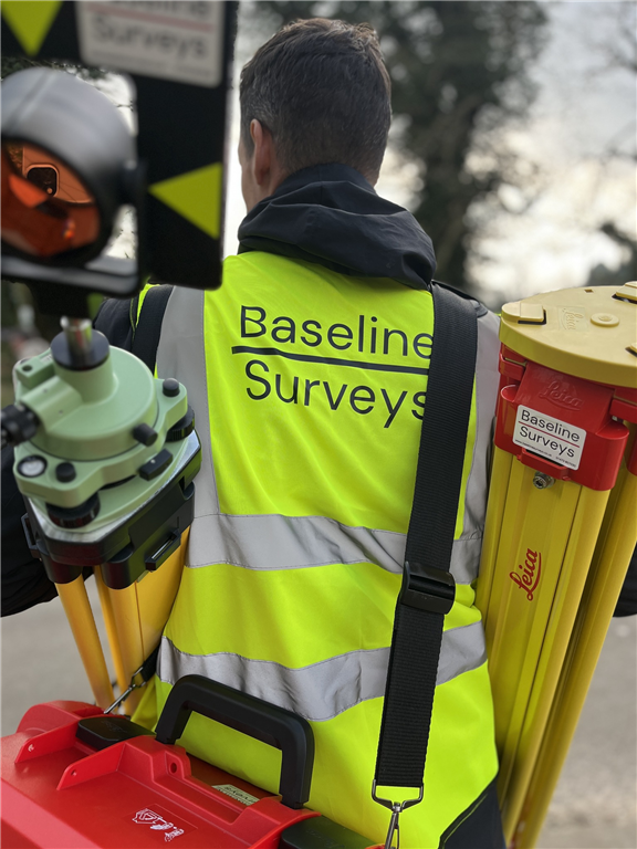
Baseline Surveys consists of a dedicated and experienced team who have worked together closely at various companies over the last 20 years before coming together to form Baseline Surveys. The hand-picked individuals who make up our team and the way we work together are at the heart of who we are and this in turn enables us to deliver the high-quality surveys and exceptional level of service our customers have come to rely on.
Our Services
Measured Building Surveys
No two buildings are exactly the same and for our clients, it is often crucial to have the most accurate drawings and models of their target properties as possible. The project might be renovation works, building extensions, planning application and design works, historic records, internal area calculations and the list goes on.
Whether you require detailed floor plans, accurate elevation drawings, cross-section information or an accurate survey of any other element of a structure, we have the experience and technology to undertake even the most complex projects.
Topographic Surveys & Land Surveys
These terms are often used interchangeably and the title ‘Land Surveyor’ is often used to describe someone working within our industry.
‘Topography’ is the shape of the land including natural and man-made features. The job of a Topographic survey or ‘Topo’ is to accurately map those site features and then represent them in a useful way - often as scaled drawings created in CAD software. These might be used for many purposes but would typically include development planning, road upgrades, site-level analysis, project optioneering and so on.
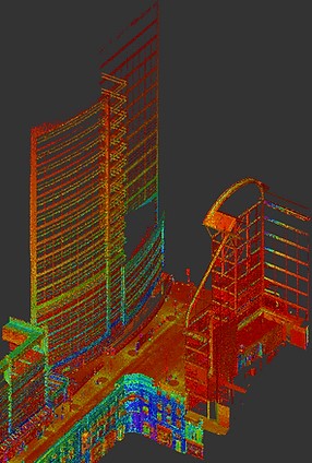
Laser Scanning, Point Cloud Surveys & 3D Modelling
The use of LiDAR via Laser Scanners gives surveyors the option to capture huge amounts of data within an area in a relatively short space of time. Combined with other survey elements, this can be a very powerful tool for complex or time-constrained situations. It can further enable the delivery of rich and very detailed datasets or models based on a client’s needs.
Boundary Surveys & Title Plans
Boundary surveys are often required where there is a dispute over ownership or otherwise where parcels of land are to be altered or transferred to others. Like a Topographic survey, a boundary survey focuses on the accurate measurement and representation of site features but, in this case, focuses on only those features that affect ownership and access rights.
Further steps are often involved such as the comparison to existing file plans or the creation of ‘Title Plans’ in an acceptable format for registration with the HM Land Registry.
At Baseline Surveys we appreciate that boundary issues are often specific and emotive. We are happy to provide guidance and surveying expertise to help you establish certainty and gain peace of mind. Please contact us directly for assistance.
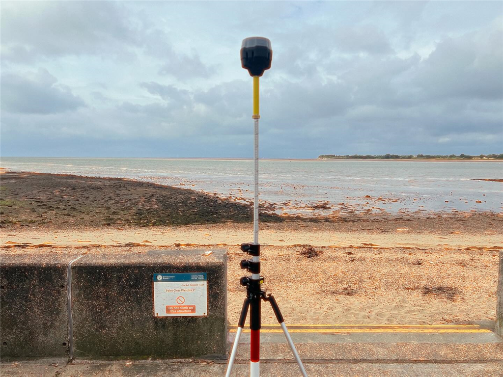
GPS/GNSS Surveys
There are now many Global satellite systems - known collectively as GNSS and including the American system GPS. Specialist survey equipment allows surveyors to establish, measure and monitor positions on earth down to the millimetre level. This is especially useful when comparing data from sites that are separated by a large distance, where the wider area is to be considered such as in flood mapping or where a site is constantly changing and any permanent reference features are likely to be disturbed.
Setting-Out
Once a client has their designs and knows where features such as foundations, drainage and roads are to be established, Baseline Surveys can attend site to ‘Set-Out’ the required positions and levels in order that they can be constructed to the precise locations required.
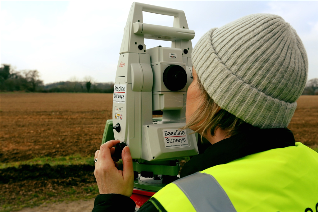
Engineering Surveys
Engineering surveys are conducted in a similar way to Topographic or Measured Building surveys but normally occur on Civil Engineering or specialist projects where millimetre level accuracy is of critical importance.
Monitoring and Volumetric Surveys
Site or feature monitoring is the process of measuring specific positions repeatedly over a given timeframe. The results are compared and monitored, sometimes in real-time, to establish if any movement occurs beyond a given tolerance. This may be required where disruptive works are happening nearby or where there is concern for the stability of an asset or ground feature.
Volumetric surveys involve the measurement and calculation of material volumes whether for arranging movement or costing purposes.
Gallery


Facebook Feed
Location Map
Baseline Surveys Serves The Following Counties
Baseline Surveys Serves The Following Towns
Find Baseline Surveys in